Nerja Hikes:
The TOP 14 Hiking Trails near the Towns of Nerja and Frigiliana
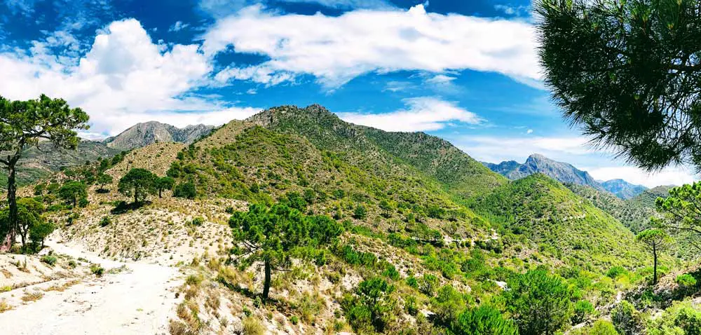
** The Acequia de Lizar Hike - Frigiliana
If you love nature and hiking, the area around the towns of Nerja and Frigiliana is fantastic. These two lovely villages are located on the edge of the Sierra de Tejeda Almijara and Alhama Natural Park, as well as next to a beautiful nature reserve along the cliffs of Maro. There are wonderful trails to be found throughout the area, ranging from easy (just a leisurely stroll through the mountainside)... to more advanced trails like hiking to the Pico de Ceilo!
The rugged yet beautiful Tejeda, Almijara and Alhama Natural Park is a protected area that stretches across two Andalucian provinces (Malaga and Granada) and covers over 40,662 hectares of beautiful landscapes. The maximum elevations reach over 2000 meters above sea level, with iconic peaks like the Tejeda and Maroma offering a huge range of hiking experiences...
The two villages are just 10 - 15 minutes apart with Nerja on the coast and Frigiliana to the north in the hills.
The Top 14 Frigiliana and Nerja Hikes - What to Expect
As we delve deeper into these Nerja hikes, you will discover an area covered with fragrant Aleppo pines which create a natural canopy and wonderful shady trails for us to explore.But the area is not only about pine forests, you will also find other important native trees like the Holm Oak, the Hawthorn and the majestic Palmito. And the Chillar River Gorge, which runs alongside many of these trails, is home to willows, poplars and amazing rock formations shaped by thousands of years of flowing water.
The park's wildlife is as varied and impressive as its landscapes, and if you are lucky, you will catch a glimpse of the magnificent Iberian ibex, as well as smaller creatures like wild boar and the elusive red-tailed fox.
The hiking around Frigiliana and Nerja is truly a rewarding experience and something we highly recommend... so let's get started exploring the TOP 14 Frigiliana and Nerja hikes!
Nerja to Frigiliana
** Trail on the Nerja to Frigiliana Hike
Difficulty: Difficult
Duration: 5.5 hours
The route from Nerja to Frigiliana is a scenic walk through the Natural Park of the Sierras of Tejeda, Almijara and Alhama. The journey begins at the famous Nerja Caves, a monument listed in the Guinness Book of Records, and is part of the 5th stage of the GR-249 "Gran Senda de Málaga".
The route begins on a wide path that winds through a vast pine forest and leads to the El Pinillo recreational area. From there the trail gradually climbs with views of the Barranco de la Coladilla ravine and the Mediterranean Sea in the background.
Highlights include the Fuente del Esparto, a natural spring where you can fill up on drinking water, and the Collado de los Apretaderos, which offers stunning views of the Barranco del Río Chillar.
The trail then descends and climbs several more times before ending in the dry riverbed of the Barranco del Río Higuerón, where you will finally reach the beautiful town of Frigiliana.
El Pinarillo Recreational Area - Fuente del Esparto
** Trail to the El Pinarillo Recreational Area
Difficulty: Easy
Duration: 2 hours
This is a shorter version of the trail above, it starts in the same location and ends at the "El Pinillo recreational area". It's great for those that want a short and easy hike and not too much of an up hill climb. Once you reach "el Pinillo" there are picnic tables and the area is shaded...perfect for a nice lunch with friends.
Pico de Cielo
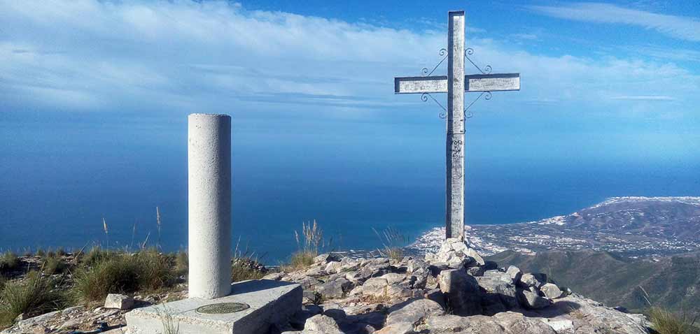
** Nerja Hike - Pico de Cielo Cross
Difficulty: Difficult
Duration: 5 - 7 hours hours
The Pico del Cielo hike is well known for its stunning views and challenging climb. It starts at the same location as the previous two hikes, near the Nerja Caves, but branches off to the right and heads north instead of heading towards the El Pinillo recreation area.
The trail to Pico del Cielo will take you past a variety of beautiful scenery, including pine forests and rocky cliffs, and will eventually lead you to one of the highest peaks in the area (Pico del Cielo actually translates to Sky Peak or Heaven's Peak). Once you reach the summit, you will be rewarded with amazing panoramic views of the surrounding mountain ranges, the Mediterranean Sea and, on a clear day, the African coast.
This hike is generally considered challenging. It involves significant elevation gain and some steep, rugged sections that require a good level of fitness and hiking experience. The total walking time can vary depending on your pace, but on average it takes about 5 to 7 hours to complete the round trip. We recommend starting early in the day and definitely avoid the summer months!
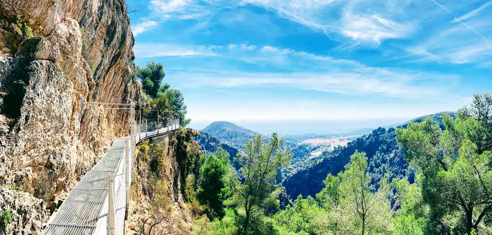
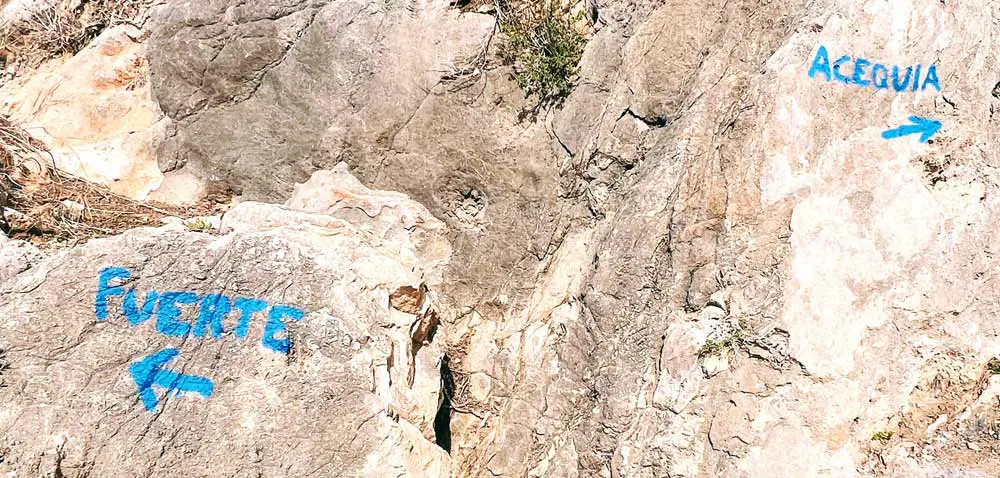
The Acequia de Lizar Hike (Caminito del Rey of Frigiliana)
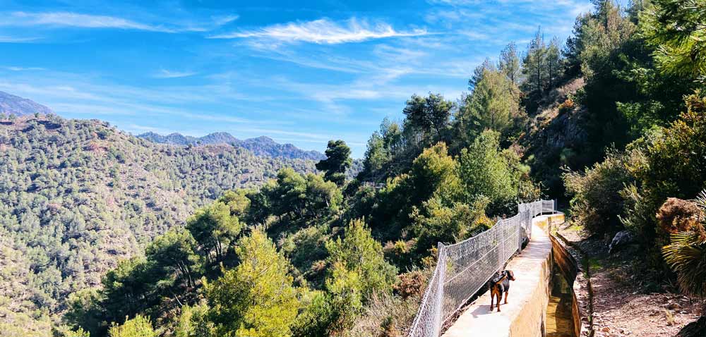
** Frigiliana Hike - Acequia (Water Canals) de Lizar
Difficulty: Easy
Duration: 1.5 hours / 3-4 hours
The Acequia de Lizar Hike, often referred to as the "Caminito del Rey of Frigiliana", is a wonderful but lesser known trail located near Frigiliana. It is compared to the more famous Caminito del Rey because of its unique platforms that cling to the edge of the cliffs.
The trail follows an old water channel (acequia) that was once used for irrigation. It winds through the pine forest above Frigiliana and has wonderful views of the surrounding mountains and valleys. The hike takes you along a cliff path that has been built on top of the water channels. Railings have been added for safety, but they stop after about 40-45 minutes of walking. From this point, you have to be very careful, we recommend you wear shoes that can get wet and walk in the water channel itself.
Due to the nature of the trail, with narrow paths and cliff walks, it's not recommended for those with a fear of heights or young children. If you stop at the point where the railings end, the hike is relatively safe and will only take about an hour and a half. If you continue, the hike can take 3-4 hours.
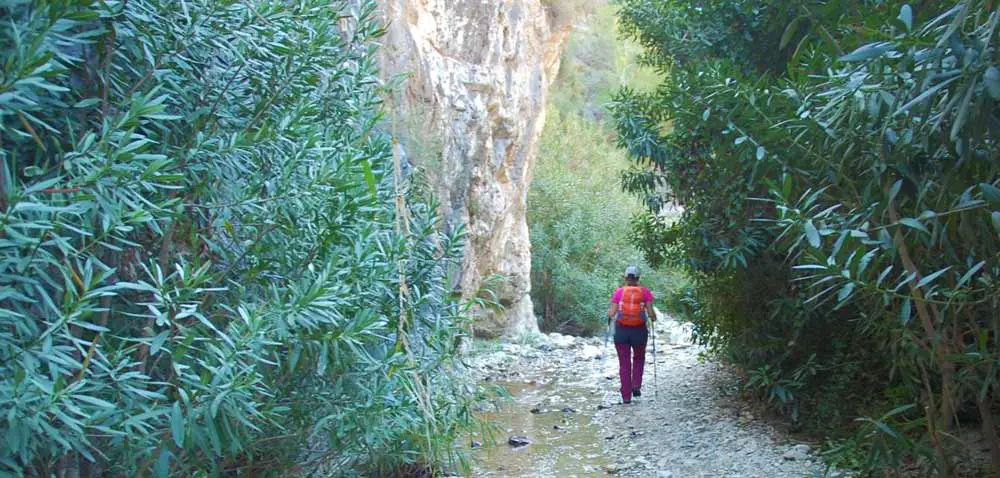
Rio Chillar Walk
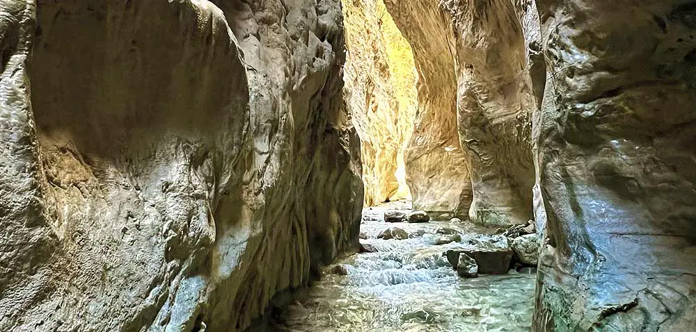
** Nerja Hike - Rio Chillar Walk & Gorge
Difficulty: Medium
Duration: 3 hours
The Rio Chillar Walk is a wonderful walk that I have done many times with my kids. It starts just outside the village of Nerja and is the most popular walk in the area. It will take you along and through the riverbed of the Rio Chillar, which means you will be walking through water most of the way.
The walk is very unique and somewhat adventurous and is made even more spectacular by the surrounding pine forest, unique rock formations and narrow canyon walls known as "Los Cahorros". For most of the hike you will walk through these narrow gorges where the water is up to your knees, if not higher. The trail eventually leads to a series of clear pools and small waterfalls, perfect for a refreshing swim and a relaxing picnic.
The Rio Chillar Walk is generally considered to be of medium difficulty. The challenge comes mainly from walking on uneven, rocky riverbeds and wading through water that can vary in depth depending on recent rainfall. It's also more about stamina than steep climbing, as the elevation gain is minimal.
The total length of the hike can also vary depending on how far along the river you choose to walk, but a typical round trip can take anywhere from 3 to 6 hours (depending on where you start and stop). Most people walk at a leisurely pace and stop along the way to enjoy the natural pools and other scenic spots.
El Fuerte Summit
** Frigiliana Hike - El Fuerte Summit
Difficulty: Medium
Duration: 4 - 5 hours
The "El Fuerte Summit" hike is another popular trail that starts in Frigiliana. Known for its breathtaking views and challenging climb, this hike is a favorite for both locals and tourists.
The trail to El Fuerte, which translates to "The Strong," starts at the top of the village and climbs steeply to the summit. For most of the hike, you will enjoy beautiful views of the surrounding countryside, the whitewashed village of Frigiliana below, the Mediterranean Sea in the distance, and the fragrance of wild rosemary, lavender, and thyme growing along the trail.
The hike to the summit of El Fuerte is considered to be a very challenging one due to the steep incline and rugged terrain. The trail can be quite strenuous, especially during the ascent, and requires a good level of fitness and stamina.
The return trip usually takes 4 to 5 hours, depending on your pace. The climb is the most time-consuming and physically demanding part of the trek. The descent is much faster.
Al Concar
** Frigiliana Hike - Al Concar
Difficulty: Medium
Duration: 4.5 hours
Next on the list is the Al Concar route, a quiet and picturesque hike that begins at the historic Plaza del Ingenio in Frigiliana... at 290 meters above sea level. As you begin your journey, you will follow a path that gently slopes to the east, leading you through a scenic 400-meter descent to the tranquil bed of the Higuerón River. This first section of the trail will immediately immerse you in the natural beauty surrounding the town.
As the trail continues north along the riverbed, you'll pass the famous Pozo Batán, well known to many local hikers and important for its role in irrigating the nearby terraces.
The walk to Al Concar is pleasant and easy, following the river uphill. There is a rest area along the way, perfect for a quick stop to enjoy the scenery.
Further along, at about 3.5 km, look out for the small "Cruz de Napoléon", a local landmark that is shrouded in mystery. The route ends after a 6 km hike upstream... revealing the rustic beauty of a ruined farmhouse that marks your destination.
The return trip follows the same route back to Frigiliana.
Lomas de Chillar
** Frigiliana Hike - Lomas de Chilar
Difficulty: Easy
Duration: 2.5 hours / 5 hours
The "Lomas de Chillar" hike is relatively short (2.5 hours) and can be combined with the "Cruz de Félix" and "Cruz de Pinto" hikes (5 hours), giving you a bit more of a challenge and of course more stunning panoramic views! This route also departs from Frigiliana (at the Plaza del Ingenio) and descends along the Cuesta del Alambique, which leads to the Higueron River. It features a mixture of historical and natural elements, like the dark cave and the Cahorros ravine, known for its narrow and confined passages.
The trail then joins the Cruz de Pinto route, where the terrain becomes more challenging as it climbs to the Cruz de Pinto, a small sanctuary built in 1643. The trail then continues to intertwine with the Cruz de Félix route, reaching yet another high point at the Cruz de Félix monument. The trail then joins the Lomas del Chillar (Chillar Hills) and crosses a variety of landscapes, ending at the Barranco del Agujero ravine.
The return to Frigiliana is marked by a slight descent, passing by the Pozo Batan (fountain) and ending at the point of departure. The best time to do this route is in the spring, when the weather is clear and the ground is dry.
Cruz de Félix
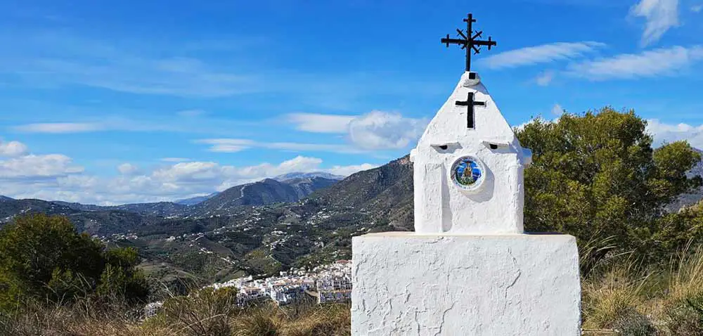
** Frigiliana Hike - Cruz de Félix
Difficulty: Easy
Duration: 2.5 hours
This is another easy hike that starts from the Plaza del Ingenio in Frigiliana and climbs to the top, where you will be rewarded with spectacular views of the coast, the surrounding mountains and the entire Costa del Sol. Just follow the signs and you should be able to get there and back in 2 and a half hours. The trail is marked in blue.
This is a great hike if you don't have a lot of time, but it's even better if you combine it with the "Lomas de Chillar" hike above and the "Cruz de Pinto" hike below.
Cruz de Pinto
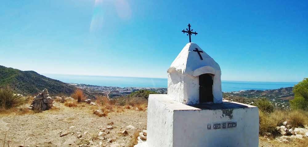
** Frigiliana Hike - Cruz de Pinto
Difficulty: Easy
Duration: 2 hours
The La Cruz de Pinto hike is a relatively easy hike compared to some of the others. And it has a wonderful story to go with it...
Legend has it that in 1643, a man named Francisco de Pinto was commanding three ships sailing from Verona to Cádiz when a life-threatening storm threatened to sink him and his crew. In desperation, Francisco de Pinto prayed for divine intervention and vowed to build a sanctuary on the highest mountain visible after the storm...if they survived.
Miraculously, the seas calmed and he kept his promise, building the shrine on the site now known as the Cruz de Pinto. Since then, this sanctuary has been a place of devotion for the town of Frigiliana. The walk will take you through the riverbed to this small white shrine... La Cruz de Pinto.
From the Guardia Civil barracks in Frigiliana, the trail descends east to the bed of the Higuerón River (depending on the season, the riverbed can be full of water). The trail then heads south, where, after a short distance, you will begin your ascent.
To return, simply follow the same route back to Frigiliana.
Acebuchal Ghost Village Trek
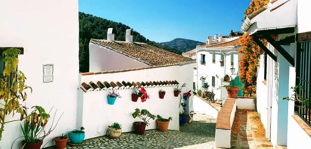
** Acebuchal Lost Village Streets
Difficulty: Easy to Moderate
Duration: 2.5 hours
The hike from Frigiliana to the Lost Village of Acebuchal is a popular route that combines the rugged natural beauty of the surrounding mountains with the charm and intrigue of this remarkable town.
The hike usually starts from the village of Frigiliana, but you can easily drive closer to Acebuchal and shorten your hike.
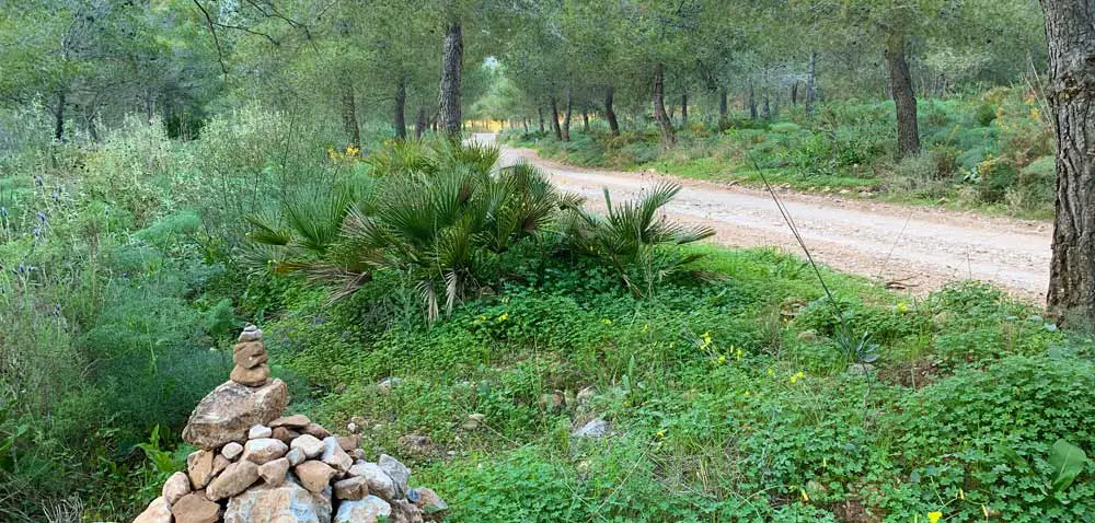
The Acebuchal Trail winds through the beautiful landscapes of the Sierra de Almijara Natural Park and you will find paths and roads surrounded by lush vegetation, olive groves and pine forests. The road is generally in good condition, with only a few bumpy and rocky stretches.
What is the Acebuchal Ghost Village? The town of El Acebuchal was abandoned in the middle of the 20th century due to political unrest and the fighting that took place in the forests surrounding the village during the Spanish Civil War.
It remained uninhabited for about 50 years, until recently, when a descendant of the village decided to restore it... preserving its once rustic mountain charm. Entering El Acebuchal is like stepping back in time and gives us a glimpse of what rural Spanish life used to be like. Be aware that there is very little cell phone or wifi reception!
The hike from Frigiliana to El Acebuchal is usually about 6 kilometers one way and takes about 2 to 3 hours, depending on your pace. This makes it a manageable half-day walk for most hikers.
Once there, take some time to explore the village. It will only take you about 20 minutes. And then have lunch at Bar Acebuchal... it's the only restaurant in town and it's wonderful. You have to make a reservation before you go.
Venta Cebollero
** Frigiliana Hike - Venta Cebollero Landscape
Difficulty: Difficult
Duration: 6 - 7 hours
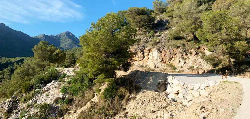
This is a tough walk through the hills behind Frigiliana, well... let's call them mountains... the trail takes you 17 km north of town to the ruins of the Venta de Cebollero, an old guesthouse that was in use until the 1920s and was an essential stop for the tired and thirsty muleteers who used this route to cross from the coast of Nerja and Frigiliana into the province of Granada. They transported fresh fish and fruit from the coast and exchanged it for other products like rice and cereals that didn't grow in this area.
You will also find, usually in the winter, a small spring on the left side of the road where you can fill your water bottles.
To go back, you have to retrace your steps, passing the village of Acebuchal in the ravine. At this point you can choose to stroll through the streets of the village or return to Frigiliana.
Junta de los Rios
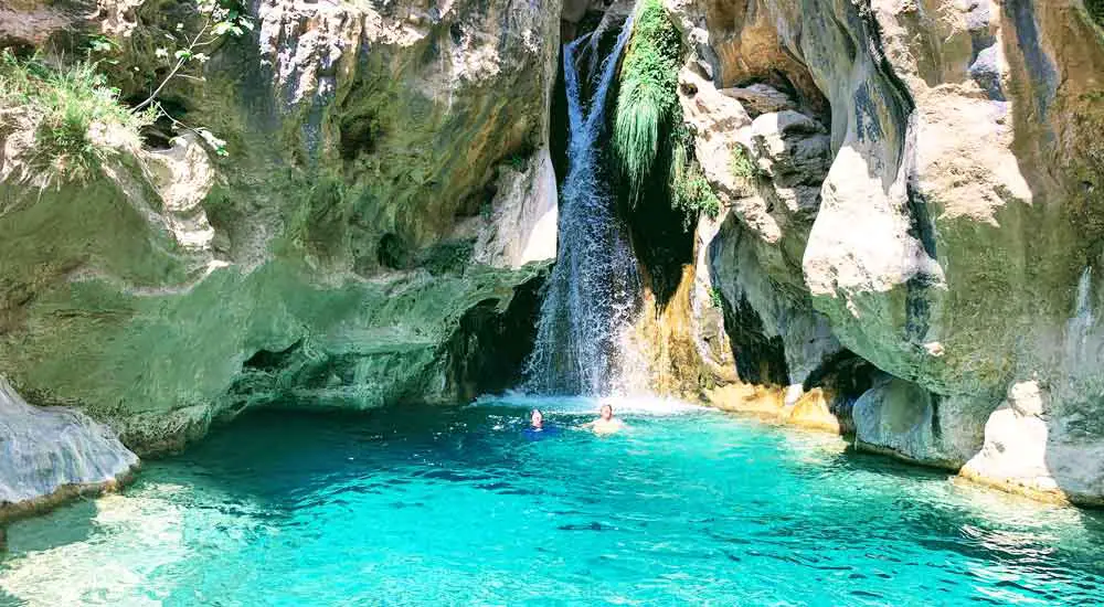
** Best Otivar Hike - Junta de los Rios
Difficulty: Medium to Difficult
Duration: 4 - 6 hours
This hike is not in Frigiliana or Nerja, in fact it's located 35 km away outside of a small rural town called Otivar, in the province of Granada, but because the hike is so spectacular (and a great option for a day trip)... we thought it would be worth mentioning here. The drive from Nerja to Otivar will take about 40 minutes.
The Junta de los Rios hike is an incredible trail that takes you through a beautiful canyon near Otívar, following the Rio Verde. Here you will enjoy the sparkling blue river, cascading waterfalls and natural pools perfect for swimming.
The trail will take you along the river bed, following rocky paths that wind through the forest, up steep slopes to the mountain tops and back down again... finally ending at the place where the two "rivers meet", known as the "Junta de los Rios". This spot is simply magnificent, with the merging waters creating a spectacular waterfall and a large torquoise pool that is just what you need after a long day of hiking.
The Junta de los Rios hike is considered moderate to difficult, with some elevation gain (but not too much), and the terrain can be uneven and rocky. The trail does require a fair amount of walking and some skill to navigate around the rocks.
The hike usually takes about 4 to 6 hours, depending on your pace and how much time you spend enjoying the natural pools and scenic spots along the way. But you can easily spend the whole day here, as we have... many times.
Caminito del Rey
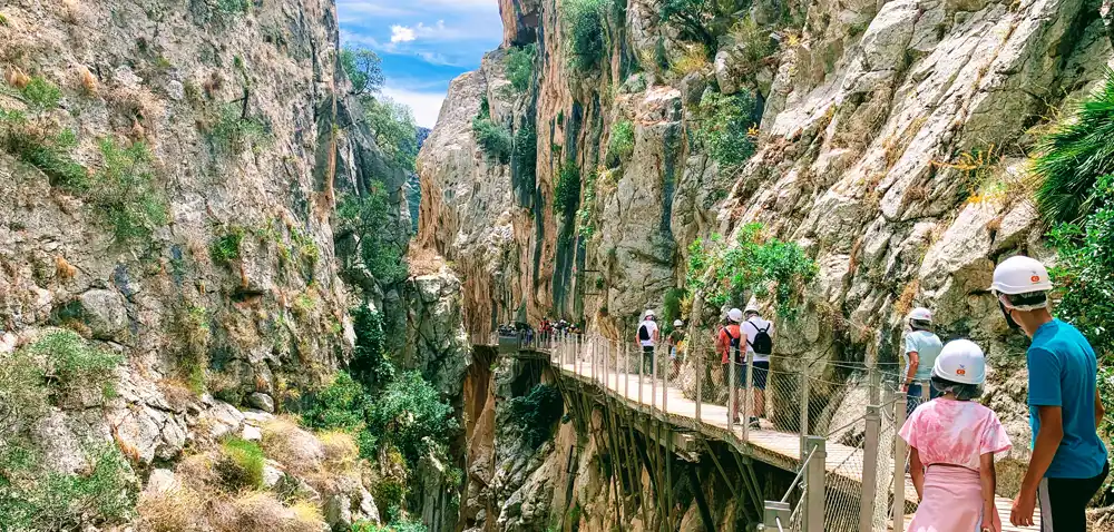
** Famous Malaga Hike - Caminito del Rey
Difficulty: Easy to Medium
Duration: 4 - 6 hours
This hike is also not in Nerja, but it's not far either. And if you enjoy hiking and don't know about it, you're missing out!
Located just north of Málaga, the Caminito del Rey is a famous hiking trail known for its breathtaking views and exciting boardwalks that cling to the edge of a gorge.
It takes about 1.5 to 2 hours by car from the towns of Nerja and Frigiliana to reach the hike, and it's very different from any other hike you'll do in the area.
The trail runs through the Desfiladero de los Gaitanes ravine, where a series of footpaths wind along the steep walls of a narrow gorge (originally built for workers to reach a hydroelectric plant).
Once known as the most dangerous trail in the world, and after extensive renovations for safety, the Camino del Rey has become one of the most popular tourist destinations in Andalucia. It's a must-do for any adventure seeker visiting Spain and is now considered one of the most spectacular hiking routes in Europe.
- Caminito del Rey Prices 2024
- How to Find Caminito del Rey Tickets
- How to Arrive
- Opening Hours / Best Time to Visit
- Where to Stay & the BEST Caminito del Rey Hotels
- Everything You Need to Know About the Caminito del Rey - Ultimate Guide 2024
Don't Forget these TOP 10 Hiking Essentials!
- Hiking Backpack: A durable and comfortable backpack is a must for carrying supplies. Look for one with multiple
pockets and hydration compatibility.
The BEST option: TETON Sports Oasis Hydration Backpack
- Water Bottle or Hydration System: Staying hydrated is important. A reusable water bottle or hydration bladder can come in handy.
The BEST option: CamelBak Water Reservoir
- Hiking Boots or Shoes: It's all about the shoes! Proper footwear is key for hikers! Choose boots or shoes
that provide good support and traction.
The BEST option: Merrell Hiking Shoes
- Moisture-Wicking Clothing: Clothing that wicks away sweat can keep hikers comfortable in all weather conditions.
The BEST options: Columbia Men's Convertible Hiking Pant /
BALEAF Women's Waterproof Hiking Trousers
- Rain Jacket or Weather-Resistant Outerwear: A lightweight, waterproof jacket can protect against unexpected weather changes.
The BEST options: Marmot Men's Eco Waterproof Jacket /
Little Donkey Women's Waterproof Jacket
- First Aid Kit: Safety first! A compact and well-stocked first aid kit is a must-have.
The BEST option: Medi Mini First Aid Kit
- Navigation Tools (GPS or Compass): Reliable navigation tools are important to stay on track.
The BEST option: Garmin eTrex 10 Outdoor Handheld GPS Unit
- Headlamp or Flashlight: For hikes that may extend into the evening or for cave exploration, a good light source is important.
The BEST option: AENNON Rechargeable - 30 Hour - Waterproof Head Lamp
- Multi-Tool or Pocket Knife: Useful in a variety of situations, from repairing gear to preparing food.
The BEST option: Leatherman Wingman Multi-Tool
- Portable Power Bank: Keep electronic devices like smartphones or GPS units charged.
The BEST option: Anker PowerCore 10000 Portable Charger
Safety and Preparation
When doing any of these walks in Nerja, it's important to be prepared. Here are some general tips for a safe hiking experience:
- Always inform someone of your hiking plans and estimated time of return.
- Carry plenty of water and some energy-boosting snacks.
- Wear appropriate footwear and clothing for the terrain and weather.
- Always carry a map or GPS, especially if you're unfamiliar with the trails.
- Respect the environment by staying on designated trails and picking up after yourself.
- Enjoy the natural beauty of Frigiliana and Nerja! 🤩
Save money on your next trip with our favorite travel websites!
| Find the Cheapest Hotels: | |
| The Largest Selection of Villas & Apartments: | |
| Cheapest, Most Reliable Car Rentals: | |
| Best Bus & Train Fares: | |
| Huge Selection of the BEST Tours & Activities | |
| Discount Tickets to Museums & Attractions | |