Costa Tropical Maps
Where is the Costa Tropical?
- The Costa Tropical is an area of coastline in Southern Spain. It is located in Andalucia in the Province of Granada. (see detailed map)
- It is situated between the Costa del Sol and the Costa Almeria, only 5 minutes from the popular Costa del Sol town of Nerja.
- The four (4) most popular towns in the Costa Tropical, from west to east are: La Herradura, Almuñécar, Salobrena and Motril.
- The Costa Tropical is 50 minutes to the South of the city of Granada and 50 minutes East of the city of Malaga.
- There are three (3) airports within an hour and a half from the center of the Costa Tropical, Granada Airport, Malaga International Airport and the Almeria Airport.
- The total area of the Costa Tropical is 786.88 km2 (303.82 sq mi)
Distances in the Costa Tropical | ||
| From | To | Distance |
| Almuñécar | La Herradura | 9 km |
| Almuñécar | Salobrena | 24 km |
| Almuñécar | Motril | 31 km |
| Costa Tropical | Nerja | 15 km |
| Costa Tropical | Granada | 89 km |
| Costa Tropical | Granada Airport | 94 km |
| Costa Tropical | Malaga | 78 km |
| Costa Tropical | Malaga Airport | 91 km |
| Costa Tropical | Almeria | 131 km |
| Costa Tropical | Almeria Airport | 147 km |
The Four Largest Towns in the Costa Tropical

Maps ➜ Costa Tropical, Spain, Andalucia, and More...
Here you will find maps of the Costa Tropical of Spain, a Spain map, a map of Andalucia, and local Costa Tropical town maps.
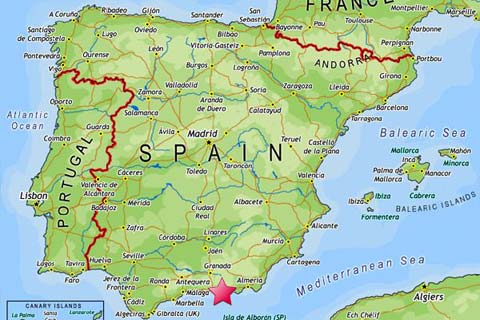
Map of Spain
Click to Enlarge
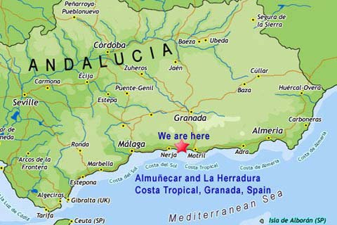
Map of Andalucia
Click to Enlarge
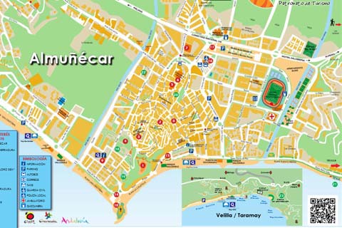
Map of Almuñécar
Click to Enlarge
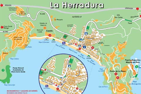
Map of La Herradura
Click to Enlarge
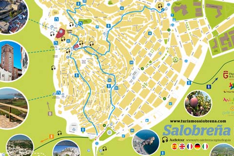
Map of Salobreña
Click to Enlarge
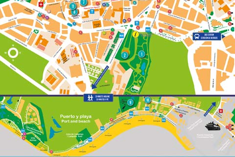
Map of Motril
Click to Enlarge
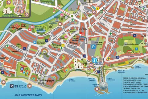
Map of Nerja
Click to Enlarge
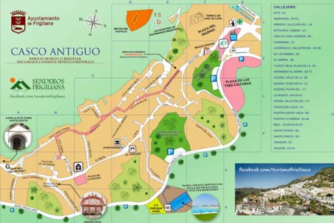
Map of Frigiliana
Click to Enlarge
Surrounding Areas