Hiking in Lanjarón
Three Lanjarón Walks...
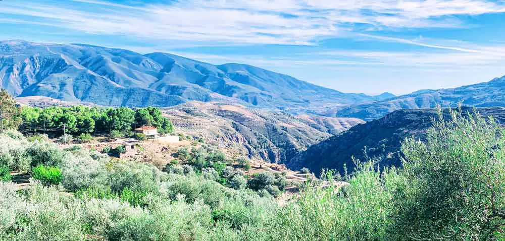
On a brisk, cool day in October or November as a light breeze floats through the Chestnut trees and fresh water pours down from the Sierra Nevada Mountains filling the irrigation canals that gush all around you...Or when the hills come alive in early spring with bursts of bright color and the memerizing smell of orange blossoms...
This is when you want to hike the beautiful trails around Lanjarón!
Check out the Alpujarra villages: Lanjarón - Órgiva - Pampaneira - Bubión - Capileira Pitres - Trevélez
1. The Acequia Aceituno - Cecarta Trail
** Lanjarón Hike - Acequia Aceituno - Cecarta Trail
Acequia Aceituno - Cecarta Trail
Trail Type: Circular
Distance: 5.8 km
Time: 2h 30m - 3h
Difficulty Level: 2
Starting Point: Ayuntamiento Plaza
Ending Point: Center of town
Find more detailed information here: Acequia Aceituno ➜ Cecarta Trail.
The Acequia Aceituno - Cecarta Trail is the first of Lanjarón's three main trails, it's a circular trail that starts in front of the town's Ayuntamiento (town hall) on the eastern end of the village.
The trail will take you about 2.5 to 3 hours, depending on your speed, and there are plenty of nice places to stop along the way.
About 45 min to 1 hour after you start, you will find a great spot for a picnic. There are a few picnic benches, shady areas, and gorgeous views of the valley below. It's a great place to stop, just after your hardest ascent... for a rest and a quick lunch.
Acequia Aceituno - Cecarta Trail - Starting Point
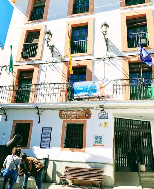
** The Lanjarón Ayuntamiento and Walks Footprints.
Make your way to the Ayuntamiento on the eastern end of town. It's a tall white building with a canon in front (the canon was used during the war to fight off Napoleon’s troops that had descended on Lanjarón).
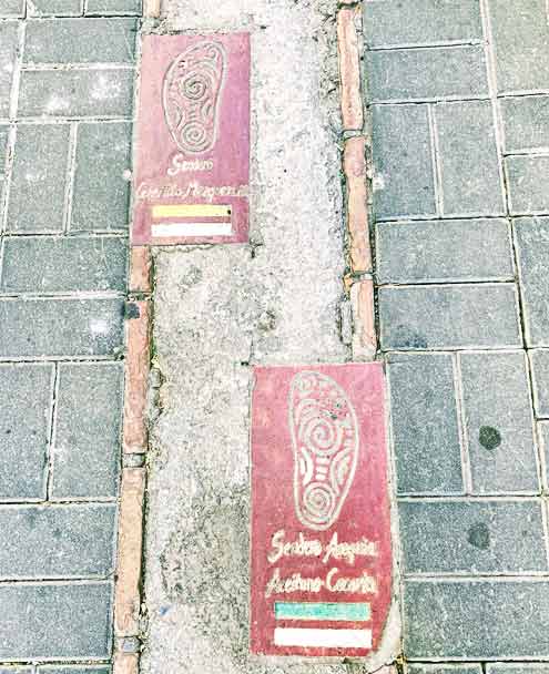
There is a round-about just in front of the town hall. Cross over and you will notice footprints etched into the sidewalk, indicating which way to go. Continue up into the Hondillo neighborhood to your left.
Follow these footprints until you get out of town.
Acequia Aceituno - Cecarta Trail - Hondillo Neighborhood
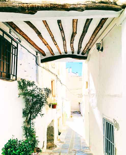

** The Hondillo Neighborhood, flowered balconies, and tinaos.
Pass through the town's old quarter, el Hondillo, where you can explore some of its pretty flower-filled streets and alleys and the characteristic 'tinaos' (covered alleys and wooden beams) that were built by the Moors.
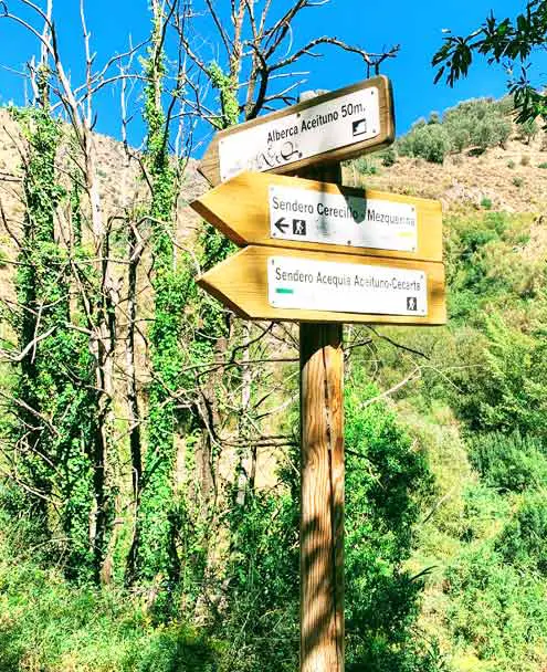
As you get towards the edge of town, watch for the signs and turn left. Head straight up out of town and continue following the footprints. At the highest point, you will reach a sign that points the way towards the 'Acequia Aceituno - Cecarta Trail'. You will go to the right.
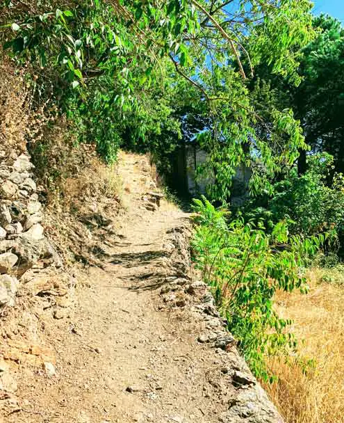
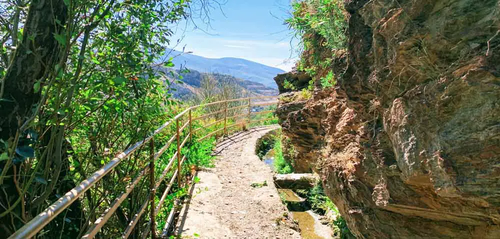
** The trail leaving town behind Lanjarón.
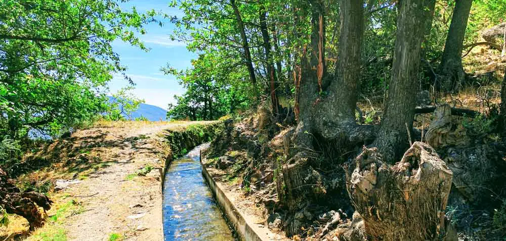
Follow this part of the trail for about 35-40 minutes, you will pass some old farmhouses, mossy fountains, and irrigation canals. The path ascends gently through lush forest along the edge of the mountain... with the Rio Chico below.
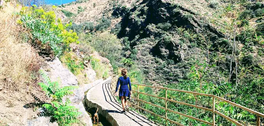
Parts of the walk are on dirt paths and other parts are paved with railings that wrap around the cliffs and run along the rushing water channels. All parts are stunning!
This is a great walk for families since most of the walk is shaded, safe, and kept cool from the rushing fresh spring water all around you.
** Lanjarón Hike - Acequia Aceituno - Cecarta Trail
After walking for 35 minutes, you will turn sharply to your left and climb up for about 25 minutes. The first part is a dirt switchback that goes steeply up the mountain until you reach the road. At the road, turn to your right and continue climbing until you see the dirt path again on your right-hand side.
From there, you will climb some stone steps where you will find the rest area with picnic tables.
** Lanjarón Hike - Acequia Aceituno - Cecarta Trail
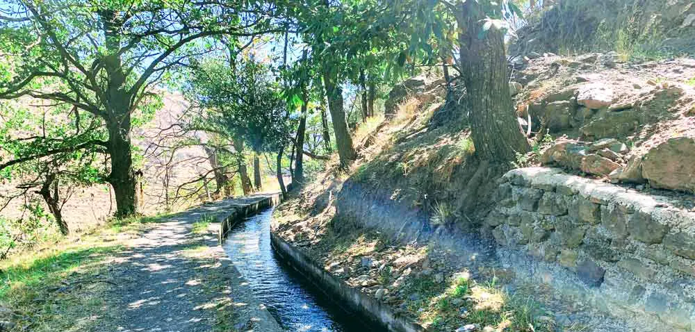
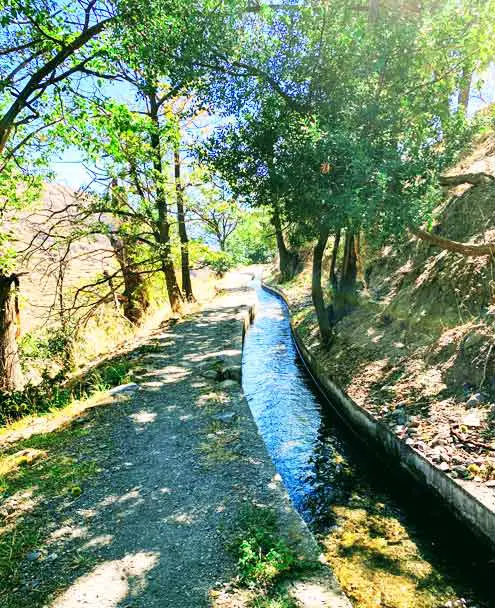
After a quick break, continue climbing just a little more until you reach another road. Follow it to your RIGHT (the sign here was a little unclear). It will take you up into a chestnut forest where you will meet up with the irrigation canals again.
From this point, follow the signs until the end of the hike. The rest of the hike is the most beautiful and mostly flat. You will walk along the water channels for most of the way, passing old farms, fruit orchards, horses, an old wheat thrashing platform, and some spectacular views.
Enjoy!
Find more detailed information here: Acequia Aceituno ➜ Cecarta Trail.
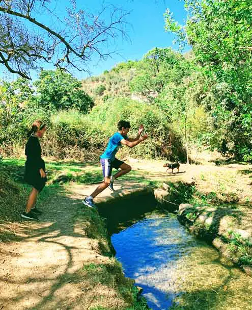
** Acequia Aceituno - Cecarta Trail - Irrigation Canals & Fun!.
Save money on your next trip with our favorite travel websites!
| Find the Cheapest Hotels: | |
| The Largest Selection of Villas & Apartments: | |
| Cheapest, Most Reliable Car Rentals: | |
| Best Bus & Train Fares: | |
| Huge Selection of the BEST Tours & Activities | |
| Discount Tickets to Museums & Attractions | |